‘To govern, it is necessary to render visible the space over which government is to be exercised’ (Rose, 1999).
‘From the national postal service to the public telephone to the license plate on every registered vehicle, media are at work replacing people with their addresses.’ (Kittler, 1996).
Introduction
Long before the arrival of popular geo-services such as Google Maps in 2005, the technical foundations for the implementation of location-based platforms were already in place. The Open Geospatial Consortium (OGC) had developed location standards that were already fully operative in projects within the military, government, and academic sectors: GML (Geography Markup Language), WMS (Web Map Services) and WFS (Web Feature Services). A further series of developments were necessary to provoke the change in the way we access and produce location information that we are currently witnessing: higher Internet connection capacity, the increase of computing processing power relative to price, new Internet protocols (XML, Simple Object Access, etc.), along with the social adoption of GPS (in-built in mobile devices and permitting site-specific capture, geocoding and retrieving of media) and especially social media platforms.1 The confluence of all this factors resulted in a new configuration of GIS systems, the so-called geoweb and its myriad of locative media platforms, which facilitated different modes of production and consumption of geocoded data. Interestingly enough, locative media platforms we are familiar with today have not been built on the set of technologies and standards developed by the OGC, instead these systems operate on much simpler technologies: geotags, KML, geoRSS, APIs, etc. Hence, due to their comparative technical complexity, the OGC standards remained the domain of experts; whereas the new standards would enable the so-called volunteered geographic information (VGI) phenomenon. All in all, the deployment of this new technical system has brought about an explosion of user-generated spatial annotations that nowadays populate urban spaces in the form of layers of geocoded media. The process of social adoption of location platforms, however has been gradual and far from unproblematic.2
The multiplication of spatial annotations has precipitated as a consequence the emergence of processes of stratification of space that has rendered certain places – and some aspects of those places – visible while others have been left obscured.3 The critique of in/visibility in locative media has mainly revolved around issues of representativeness and inclusion. The following analysis touches on another angle from which to view the problem of visibility, shifting the focus from the politics of representation to an analysis of the politics of code and appearance. Such approach entails making the workings of these technologies visible as well as examining how social space is made visible to them.4
Imagining Places: from Representation to Computational Processes
Since its creation in 2004 Flickr has been one of the most popular photo-sharing platforms on the Web. Although hosting 6 billion images (August 2011) looks less impressive when compared to main competitor Facebook’s 36 billion images (February 2012), given that the latter do not keep location metadata records for photos, it makes Flickr the largest database of user-generated geocoded content on the Internet. Most importantly, Flickr links geolocation with a tagging system and other forms of social metadata (comments, notes, favourites) that allows rich media annotations, providing consequently further descriptions of those places media is linked to. Furthermore, Flickr’s imagery is extended out of the platform into the Web thanks to protocols that enable network interoperability (mainly JPEG/EXIF for photos and XML for sharing data across platforms). Flickr’s photostreams may be in-built in blogs or emails for example. This way Flickr’s imagery is currently integrated in the most widely used geobrowsers (Google Earth, Google Maps, and Bing Maps). Both Google’s and Microsoft’s geobrowsers datamine Flickr’s database to populate their street imagery, overlaying physical location with Flickr’s geotagged media layers. Paul Clapan has termed this form of distributed visibility enabled by network protocols ‘network scopic regime’.5 Inasmuch as the mediation of places (through books, movies, music, newspapers, travel guides etc.) has always played a significant role in how we understand and enact urban spaces, the study of Flickr represents a rich case to look into contemporary forms of the social production of space.
There are two basic forms of geotagging content in Flickr.6 Either the user can drag a photo (or video) over a map and drop it on the specific location where it was taken, a process that automatically inscribes the photo with location metadata; or Flickr may read the location metadata directly from photos taken with GPS-enabled devices. In this case location is stored within EXIF records (Exchangeable image file format) in the form of lat-long coordinates, which is an industry standard for storing metadata in media files (JPEG and TIFF for image files, and WAV for audio files). Flickr also lets users assigning a geographical accuracy level to uploaded content that ranges from world level to street level, as well as setting further privacy controls over geotagged photos through a technique known as geofencing.
The core of the photo search engine is built around the concept of what is called by Flickr ‘interestingness’: “media objects, such as images or soundtracks, may be ranked according to a new class of metrics known as ‘interestingness’”.7 Similarly, location search (Flickr Map and Flickr Places) is structured around this sorting logic. One of its employees explains in a post on Flickr Developer Blog (February 4th, 2009) the functioning of Flickr Map, particularly why users just get few results instead of the whole clutter of all geotagged photos for a place (e.g. among the potential thousands of photos of the Eiffel Tower which ones should be visible on the map):
I should probably mention at this point that if you go directly to the map and click the dots icon in the top right that you’ll see a smaller number [of photos]. This is because we added a rolling upload-date to the initial search to return the most interesting photos in the last month or so, rather than always have the same (all-time) photos show up forever, possibly reinforcing their interestingness.
The locative functionality of the platform privileges hence newness and interestingness. In an algorithmic processing where these criteria are the ordering principle, representations of place become subordinated to the flow of information. Further, the flow as such erects the governing order of the visual. The algorithm treats photos not as carriers of meaning but rather as informational objects that in their dissemination (flow) acquire qualities that are susceptible of calculation. Representation thus has the status of information. Put it succinctly, ‘it is not about signs, but about signals’. 8 In an informational milieu characterized by instability, therefore, a semiotic examination of Flickr’s photos is far less important than a processual understanding that looks at the operational logics governing the access to whatever media object and ultimately frame the production of meaning as such.
Attention-seeking Algorithms, or ‘The Economy of Interestingness’
What rules organize then the transmission of geocoded media objects in the platform? The access to data by external applications (e.g. mash-ups) is managed through an API (Application Programming Interface) that operates as an interface with Flickr’s database. Flickr’s Places API affordances include traditional data queries in location databases like looking up for information about places or geocoding methods. But it also offers more interesting possibilities for developers such as identifying places trending, that is, places driving social attention, as well as exploring places by user-generated tags, or sorting places by user profile, including the harnessing of social networks for this purpose. According to Cramer and Fuller APIs produce ‘asymmetries of power’ as they ‘establish descriptions of operations that are allowed and assigned a priority or blocked’.9 The API’s terms of service is explicit in this regard: ‘Flickr may also impose limits on certain features and services or restrict your access to parts or all of the Flickr APIs.’ Flickr’s Places API normativity includes, for instance, limitations to the amount of data it can be parsed in a single query. For some of the methods this limit is set on just 100 registers. Another example of these limitations includes the access to certain geographical accuracy levels. To illustrate, the Places API does not allow retrieving tags at the level of street and neighbourhoods where the implicit local knowledge embodied in tags could be more valuable for potential third-party applications. In this line, more important restrictions are put in place to protect the platform’s business model and prevent any potential undermining of its position: ‘You shall not – the API terms of service reads – use Flickr APIs for any application that replicates or attempts to replace the essential user experience of Flickr.com.’ Similarly, certain functions (calls or queries) are kept under the exclusive platform’s control in order to regulate the data flows outside the platform, thus guaranteeing a dominant position with respect to third-party applications. Like it is seldom the case in most social media platforms, Flick’s database is at best semi-open. Even though it does grant access to data it does so only ‘under stricture of specific grammars of action and expression’10
On the other hand, understanding Flickr’s data management needs to be extended also to the principles of circulation of geocoded media objects within the platform. In order to do so we have to look at the functioning of the algorithm. According to a post on Flick’s Blog (August 1, 2005) ‘interestingness is a ranking algorithm based on user behaviour around the photos.’ Since this algorithm is a commercial secret its workings are deliberately been black-boxed, so the variables used to measure users’ behavioural patterns vis-à-vis media objects can only be sketched by considering the information provided in its respective patent documentation. Even though, it should be noted that the design of the algorithm as it is presented in the patent does not correspond necessarily with its actual implementation. Algorithms are always subject to modifications to adjust to changing information ecologies and media practices. For example, Google’s algorithm PageRank original design as described in the patent documentation included just number and quality of incoming links as ranking criteria11, whereas its current implementation has been claimed to process more that 200 ranking variables12. With this caveat in mind, the main factors determining algorithmic ranking in Flickr as identified in the analysis of the patents Interestingness Ranking of Media Objects13 and Media Object Metadata Association and Ranking 14 are:
1. Quantity of social metadata linked to the respective media object (tags, comments, additions to favourites, additions to groups, annotations), or quantification of attention metadata as it were.
2. Access pattern to the media object (number of click throughs or views of the media object).
3. Number of users contributing with metadata.
4. Social relations between users. For instance, photo comments from a user predefined as friend or family member may carry a different weight than a comment made by a casual user.
5. Time varying behaviour of all these factors.
Unlike most algorithms that relay chiefly on implicit automatically generated metadata, Flickr’s algorithm is structured as a system for valuing attention as it is expressed in the form of human-generated metadata. Attention here is produced in the process of socialization of media objects. What is expressed in the workings of ‘Interestingness’ is not other than the economy of attention characteristic of the digital regime, whereby in an information milieu of abundance value is measured in terms of the capacity of attracting audience attention. Caterina Fake, one of Flickr’s founders, delineates the discursive underpinnings of the logic expressed in the algorithm through what she terms ‘the economy of interestingness’. I want to draw attention here to the way mentalities may translate into code. She asserted the following on her personal blog (October 25, 2005):
In any social software system there are systems of value other than, or in addition to, money, that are very important to people: connecting with other people, creating an online identity, expressing oneself — and not least, garnering other people’s attention. What is more pleasant than the benevolent notice other people take of us, what is more agreeable than their compassionate empathy? What inspires us more than addressing ears flushed with excitement, what captivates us more than exercising our own power of fascination? What is more thrilling than an entire hall of expectant eyes, what more overwhelming than applause surging up to us? What, lastly, equals the enchantment sparked off by the delighted attention we receive from those who profoundly delight ourselves? – Attention by other people is the most irresistible of drugs. To receive it outshines receiving any other kind of income.
The algorithm comprehends also a spatial dimension. In this respect, the set of patents delineates how location metadata is articulated in the measurement of interestingness. The method identifies data neighbouring relations to use them as a signal of interestingness, either by computing the proximity of media objects to user location or the proximity of media objects to other media objects previously annotated by the user15. Furthermore, location metadata records corresponding to media objects associated with a given user may also be a factor determining a personalized interestingness score:
[…] For example, the metadata processing logic may, for a particular user, positively factor into the interestingness score of an image of the Washington Monument the fact that the user has designated as favorites a large number of images associated with the Washington, D.C. area. This assumes that location metadata indicating the Washington area has been associated with the image of the Monument […]16.
Empirical Analysis: Code and Visibility
Research on geocoded media has focused prominently on mapping place representations online and cultural phenomena, as well as on the problematization of the unevenness of spatial annotation characteristic of these media geographies17. The ‘asymmetrical nature of geo-coded information’18 is represented visually by few centres concentrating most spatial annotations and wider zones that are barely annotated (Fig.1). Scott Lash describes these patterns of inequality in the production of information as a new geography composed of live zones, where the density of information flows is high, and dead zones, where flows are light or even absent19. Moreover, the patterns of unequal distribution are replicated at every granularity level, from continents (e.g. Africa and Latin America are for the most part dead zones in Flickr), to country and urban levels where usually city centres are live zones while dead zones commonly correspond to the deprived neighbourhoods in the urban periphery.

The problem of in/visibility, however, does not exhaust with inclusion (i.e. annotating dead zones). Beyond a certain threshold of inscription where zones are dense with geocoded data, which is the case of many already heavily annotated western cities, it is rather the specific ordering logics of the visible in-built in the workings of these socio-technical systems that dictate the actual conditions of visibility of places20. In this case the analysis of geocoded data needs to be advanced from the politics of representation to the politics of code and appearance. As Kitchin and Dodge propose, annotated space (‘coded space’) necessitates an ontogenetic understanding that accounts for how the technicity of software brings space into being21.
As stated previously, inasmuch as Flick’s Interestingness algorithm remains a commercial secret it is not possible to replicate it in a simulation. Through the patent documentation analysis, however, I identified the main ranking factors embodied in the algorithm, though how those factors relate to each other and what specific weight they carry in the final ranking is yet unknown. Nonetheless, and within the limits that the API imposes, it is still possible to simulate what was identified as factor number one in the algorithm ranking criteria (quantification of attention metadata), which to my understanding of the patents is the most important signal the actual algorithm would use. The visualization below shows then a comparison between a sample dataset of geotagged Flickr’s photos for London (comprised of 92729 registers) and the same dataset filtered using the Interestingness factor aforementioned (2227 final registers) (fig. 2).

The visualization shows that the distribution of objects is in relative terms more scattered in the raw data map, while in the Interestingness simulation it is more clustered. Even though the zones highlighted on both maps are roughly the same, Interestingness would make what is already visible even more prominent while rendering what was slightly visible on the unfiltered map invisible. Hence, it may not come as a surprise that the hotspots on the map correspond precisely to touristic highlights in the city. Whereas just Trafalgar Square and the British Museum were identified as prominent hotspots in the distribution of objects on the unfiltered map, on the simulation the patterns of distribution highlighted clearly more hotspots. Besides Trafalgar Square and the British Museum other hotspots made visible comprehend Piccadilly Circus, Leicester Square, Tottenham Court Road, House of Parliament, London Eye, Southbank Centre, Tate Modern Gallery, St Paul’s Cathedral, City Hall, Tower Bridge and Brick Lane. What is at stake in these results is the difference between retrievability and visibility, which is at the heart of the problem of algorithmic selectivity in ranking22. Accordingly, although a place such as London may be extensively and diversely annotated, and every single annotation can be individually retrieved, the representations of London that final users are likely to encounter are demarcated by the ordering enforced by the algorithm. This algorithmic regime constitutes thus a vector of asymmetrical visibilization in locative media.
Hotspots: the Locus of Social Desire
The calculation of attention at work in the algorithm is, however, far more complex. In Flickr attention denotes foremost intensity. Interestingness accounts for an affective dimension in data. Flickr does not measure attention based on the hyperlinking model characteristic of search engines. The ranking model is one characteristic of most social media platforms based on the measurement of user ‘interactivity with the object’23. This model measures social relations as they are expressed in the object. Affect should be read in this context then in terms of relationality i.e. the intensive relations between social networks and media objects. What carries the most weight would be the degree of responsiveness, that is to say, that further engagement with the object after it has caught the user attention (a photo view). Whether the object mobilizes an affective response in the form of a further act of communication: commenting, adding tags or notes, and foremost favouriting an object.
Furthermore, this grammatization of affect24 operated by the algorithm renders intensity traceable as it crystallizes in specific objects. If as Flickr’s website reads, ‘interestingness changes over time, as more and more fantastic photos and stories are added,’ the algorithm is then capable of sorting what objects stand out from the uninterrupted flow of images. Looking at the patent documentation sheds some light on how this sorting may be executed:
Interestingness may be a function of time […] For example, the system designer may set up the score computation to decrement the thus-far accumulated score by a predetermined percentage over time starting at the time the media object was posted. For example, this time decay may cause the score to decrement by 2% per day from the day of posting. This and other means may be employed to prevent the occurrence of “positive feedback loops” where the sorting of media objects by interestingness itself skews the results, causing those same media objects to be more frequently accessed, thereby unnaturally increasing their interestingness scores25.
It is only through a consideration of the dimension of temporality that the algorithm is able to differentiate the object’s degree of interestingness from mere redundancy. More interestingly, based on these procedures described in the patent it could be inferred that a measure of intensity may be calculated considering the maximum accumulation of attention metadata by a given media object in a short span of time. The algorithm would evaluate number of views, number of users annotating the media object and their respective social relations all in a time axis that favours diffusion and novelty over constant accumulation and positioning. Thus, the algorithm instead of finding norms (spatial fixes), i.e., the most popular photograph for a place or the most representative, it tracks users’ process of discovery of interesting photographs and media objects’ diffusion through the attention metadata accumulated in this process. Arguably, this emphasis on the temporal dimension of media consumption in terms of propagation of affect suggests an epidemic logic underpinning the algorithm. The urban imaginary as mediated by Flickr is in this way, allegedly, more likely to be populated by intensive representations of place rather than by representative representations of places (i.e. delivering relevance or authoritativeness). Thus, and despite the myriad of spatial annotations indexed, the urban spaces that are most likely visible to the final user would tend to conform to hotspots, that is to say, places driving social desire. In the same way, location-based services, and particularly social location platforms, have incorporated ‘trending places’ features that provide analytics to track in real-time the composition and fluctuation of hotspots based precisely on the same principle of computing temporal patterns in geocoded data.
Technologies of Address: from House Numbers to Places Databases
The question of visibility is also the question of knowledge. That is, under a specific spatial-visual regime what places are rendered visible? And what can we know about them? In order to understand the politics of knowledge at play in locative media we need Kittler’s supplement to Foucauldian discourse analysis. That is to say, interrogating how the rules that govern knowledge depend also on modes of technical inscription and ways of archiving and processing those inscriptions, i.e., the specificity of media-technological affordances. In this light, the question is what spatial annotations (inscriptions) are selected by a given socio-technical system. Miller and Rose propose that such a politics of knowledge should devote ‘attention to the particular technical devices of writing, listing, numbering and computing that render a realm into discourse as a knowable, calculable and administrable object’26.
An analysis of the factors shaping what spatial imageries are accessible to us has to comprehend not only understanding how geocoded objects are sorted but also how the places attached to those objects are sorted themselves within these systems. But firstly, and in order to understand the mode of ordering at work in places databases, we have to situate genealogically how space as such came to be rendered inscribable. I will draw here from the work of the geographer Reuben S. Rose-Redwood. His historical account of geocoding traces back its origins to eighteenth and nineteenth century America with the advent of the technology of address, highlighting how geocoding actually precedes GIS and GPS technologies. To Rose-Redwood the establishment of an architecture of address, namely house numbering, and later on ZIP codes (post codes) in the twentieth century, permitted the standardization of space necessary to make it legible and inscribable. Coordinated sequential numbering, and its abstract form the coordinate grid, made possible by affixing specific numerical addresses to individuals enabling thus a more efficient government of the population by securing locatability and improving the efficacy of governmental practices such as taxation and collection of census data27.
The author also identifies an important relationship between the implementation of house numbering and the emergence of the city directory. In a standard form the first city directories were alphabetical indexes of residents (including names, addresses and even occupations), organizations and public buildings with a business listing section at the end. Most versions included also a map, a street index and local history of the city. The origins of contemporary local/location platforms, particularly those based on local advertising (e.g. Google Maps, Facebook Places, Foursquare), could be located in this period with the appearance of the geocoded alphabetical indexing of the city in the form of directories. If, following Rose-Redwood, the city directory was the ‘index to the geo-coded city-text’28, local/location platforms are the equivalent of an index of the geotagged city. There are indeed parallels well worth pointing out. Both forms of media are marketing technologies inasmuch as they both profit on visibility in the listings, mainly through selling advertising services. City directories functioned also on a subscription-based model, but since in most cases even those businesses that did not pay subscriptions were still listed a way of highlighting subscribers was listing them with capital letters29. Current location-based services introduce a new development on this model by capitalizing also on the visibility of users, rendered visible to marketers through access to data analytics and direct monitoring (location-targeting).
In spite of these continuities, the places databases upon which location platforms are built represent a rupture in the mode of spatial indexation. Firstly, digital geocoding of media objects (geotagging) extends indexation beyond text (lists of people and places names) to include a wider array of media. Secondly, and this is a more fundamental difference, places databases allow the informational indexing of space as such, making possible for users of mobile location-based services, for example, to access location-specific information. Places databases, I argue, should be regarded as a new technology of address that works by assigning an unique place identifier to a specific point location in a database, allowing this way its association with a potential myriad of datasets. ‘Addresses – Kittler contends – are data which allow other data to appear’ […] ‘Addresses, literally, create channels’30. In this sense, places databases set the conditions of possibility not only for the circulation of new flows of information, but also the circulation of people and commodities. Other technologies of address such as house numbers and post codes allowed marketers to identify potential markets and reach consumers more effectively through mailings for example31. In a similar way places databases open up space for new forms of addressing and hence economic government32.
Enabling a Business-led Urban Ontology
From a formal perspective places databases are structured on the basis of underlying spatial models or ontologies. A place ontology is a data model that describes the way how places are categorized and classified, as well as how these categories are related in the database. In the case of Flickr, the platform is geo-enabled through Yahoo’s location database (Yahoo! GeoPlanet). The spatial categorization in Yahoo’s database is based on the so-called WoEID (Where on Earth Identifiers). These identifications are unique numbers that are never changed or recycled (though they can be deprecated), and since they are numerical identifiers they remain language neutral. Flickr’s geo-services works on WoEIDs but use a reduced version of Yahoo’s place ontology. Whereas Yahoo’s has a set of eleven different place types: continent, country, admin (e.g. state, region, etc.), admin2 (e.g. county), admin3 (e.g. district), town (e.g. city), suburb (e.g. neighbourhood), postal code, supername (e.g. Latin America), colloquial (e.g. French Riviera), time zone (e.g. America/Los Angeles). All organized in a hierarchical model with their respective geographical relationships: parent (a direct superior to a place), children (a direct inferior to a place), neighbors (places adjacent to a place), siblings (places that share the same parent and have the same place type), belongsto (‘places that include a given place as one of their children, or their children’s children, etc’.) and ancestors (‘places in the chain of parents for a given place’) (fig. 3); Flickr’s uses a simplified version of this ontology with less place categories (continent, country, region, county, locality and neighbourhood), and consequently with a simpler set of geographical relationships between them.

For the purpose of the analysis I will compare Flickr with another type of location-enabled platform, Foursquare. If, as I will argue, place ontologies are ways of categorizing the world, as such they also embody certain worldviews or modes of knowing the world. Granted that, a comparative analysis is valuable to shed light on the differences in the constitution of such worldviews. Foursquare is a location-based social networking platform where users basically share their actual location (a media practice known as checking-in), while getting place recommendations and local business deals as part of its use. This platform implements a different ontology approach based on what it is termed ‘venues’. Rather than standard formal geographical entities, ‘venues’ are better defined as points of interest (POIs). Foursquare’s place ontology is comprised of 8 top level categories (Arts & Entertainment, College & Education, Food, Nightlife Spots, Great Outdoors, Shops, Travel Spots, and Home/Work/Other) and 235 subcategories. Unlike the top-down place ontology of Yahoo-Flickr, the apparent simplicity and non-hierarchical organization of Foursquare’s ontology fits its bottom-up approach to location data, whereby its users are allowed to contribute adding new places to the database. In the process a given user just has to provide a place name along with either a valid address or lat/long set of coordinates to have a place indexed in Foursquare, though additional richer place metadata can also be contributed (city, state, postal code, phone, url, twitter account and a description of the place).
We are presented then with two different types of places databases, each entailing a different form of spatial categorization: geographical or topical. Whereas Flickr’s locative functionality uses a geographic taxonomy to index geocoded media (e.g. Europe > UK > England > London > Soho), Foursquare categorizes places employing topical taxonomies (e.g. Nightlife > Music Venues > Jazz Clubs). The main current locative media platforms use either one of these types (table 1). Geographical taxonomies are characteristic of GIS spatial databases. Topical taxonomies, on the other hand, have their direct predecessor in the yellow pages system of categorization. The first generation of online local search engines (Google Local, Yahoo! Local, AOL Local Yellow Pages, etc.) all shared this spatial vocabulary populated largely by business categories (e.g. shops, bars, restaurants, etc.). In fact, there is a commercial bias in this type of places taxonomy. It will suffice to look at the level of granularity of classification for commercial entities vis-à-vis non-commercial in Foursquare. For the category of ‘Home/Work/Other’, for instance, which comprises types of public and residential places, there exist 14 subcategories, whereas one single commercial category ‘Food’ has 78 subcategories. One noteworthy difference with the yellow pages industry standard categorization though, which represent a significant evolution in the nature of these ‘local’ lexicons, is that in social location platforms the vocabularies show an evolution towards more user-friendly categories more centred on human activities and lifestyle consumption, rather than designating mere business services. For instance, Foursquare’s place taxonomy includes categories such as ‘Nightlife’, ‘Great Outdoors’, ‘Gay Bar’, ‘Dog Runs’, etc.

Another line of enquiry to be considered is how places are conceptualized in these ontologies. Taking as a reference the World Wide Web Consortium (W3C) guidelines on representation of spatial data on the Web33, places databases can be said to be composed of one of the following basic types of spatial entities: locations, places or POIs (Points of Interest), or a combination thereof (table 1). ‘Location’ is a ‘geographical construct’ defined as a ‘physical fixed point’ that persists over time. The category ‘places’ designates large scale ‘administrative constructs’ (e.g. neighbourhoods, cities, regions, etc.) structured according to spatial relations (e.g. parent, children, neighbours, belongs to, etc.). Finally, a POI is defined as a ‘human construct, describing what can be found at a location’. The category is ‘used to refer to business locations and tourist or well know sites and locations’. Scale is important to differentiate POIs from places, the former referring to a finer level of spatial granularity compared to the latter. Another important distinction is that POIs are not strictly fixed to a unique location, i.e., they are mobile. POIs can move as the social use of a given location changes, e.g., when a bar is relocated and takes with it its social activity to the new location. POIs have also a temporal dimension. So, to continue with the example, when a new business opens in the bar’s former location a new POI is created accordingly. Due to this dynamic condition some locative media platforms built upon POI-based places databases allow users to create, edit and add POIs (table 1). Crowdsourcing in those cases is aimed at outsourcing the amount of labour that maintaining a POI places database up to date necessitates. Think of the sheer quantity of businesses that may close or open in a single day worldwide.
Here, I would like to draw attention to how these spatial ontologies may demarcate different fields of visibility by way of comparing Flickr and Foursquare’s respective spatial distributions of geocoded media objects (fig. 4). The visualizations reveal that the patterns of distribution are clearly distinctive for each platform. Annotations are significatively more dispersed and covering larger areas in Flickr compared to Foursquare. The hypothesis is that the different conceptualizations of place implied in each ontology set the limits for what spaces can actually be annotated and hence be visible in these platforms. In the process of spatial indexation POI-based places databases – the case of Foursquare – assign a POI to any given set of lat-long coordinates. Space is therefore fixed into discrete places with a fine level of spatial granularity. In turn, for geographically-based places databases, the same set of lat-long coordinates is converted into a place category with a coarse level of spatial granularity. By way of illustration, for the pair of coordinates ‘51.5432, -0.1519’ Flickr API returns the result ‘Camden Town’ (neighbourhood), whereas Foursquare API returns ‘The Roundhouse Theatre’ (POI). Flickr API restriction goes as far as obfuscating lat-long coordinates in a place query so a precise locale cannot be identified at all: ‘[The API] will also truncate latitudes and longitudes to three decimal points’ – Flickr’s API documentation reads. This technical limitation carries a significant consequence. Flickr’s indexation of places impedes the capture and accumulation of media annotations by private places, namely businesses.

POIs comprise a different regime of authentication for places. In the world represented in POI spatial ontologies there is no such thing as nameless places, ‘public street’, ‘the commons’ as such. Every spatial entity has a name-address(es) pair. In this sense, the POI ontology mirrors the worldview of neoliberal urban politics of privatization and disappearance of public space34. Authentication metadata for POIs may include name, current location, category, address, telephone, email, social media accounts, URI, etc. and essentially a unique place identifier. Authentication serves primarily to link information to places. This way place unique identifiers technically enable the association of data such as media annotations and visitation data with a given locale in a database and, critically, at a fine level of spatial granularity. Thus POI spatial ontologies allow places – mainly businesses – to gain media visibility and capitalize on attention value (popularity). At stake here is the very technical enabling of location-based services’ forms of capitalization on local/location data. POIs-based places databases are structural in the implementation of certain services that require to be built on top of this kind of data. For instance, marketing services for local businesses based on demographics data and visitation data (e.g. offers, coupons, loyalty marketing etc.), and local advertising that mines the connections between places and people in order to fine-tune targeting. Both marketing services and local advertising are the main pillars of the current location-based services business model. Here the production of abstract space is therefore directly linked to the circulation of commodities and capital accumulation processes.
The marxist geographer David Harvey contends that ‘spaces of representation […] have the potential not only to affect representation of space but also to act as a material productive force with respect to spatial practices’35. In this light Flickr and Foursquare encourage two different sets of spatial relations between users and urban spaces. On the one hand, Foursquare, through its participation dynamics ruled by social competition for prestige (e.g. getting badges or becoming a ‘mayor’ of a place) and commercial incentives (e.g. getting offers, discounts, coupons from businesses), promotes spatial practices of self-presentation and consumption in places. Suitably, its underlying place ontology based on the category of venues is composed primarily of commercial entities. The comparison of distributions between Flickr and Foursquare suggests also that the media geography of the latter is mainly commercial as there is a clear tendency to the formation of clusters around the so-called ‘Main Street’ (fig. 5). On the other hand, conversely, it could be argued that Flickr tends to favour the visibilization of public space while obfuscating private space. Flickr’s ontology permits a type of spatial annotation closer to that of urban graffiti as a writing practice of public space, i.e., geotagging as ‘digital graffiti’36. Different spatial ontologies thus, as it is manifested in the distribution of spatial annotations, crystalize in different stratifications of social space. These stratifications produce different fields of visibility, whereby some zones in the city are rendered legible while others are illegible. Here invisibility might imply new forms of economic exclusion as obscured places could be deprived of having more flows of people. ‘Decreased levels of economic interaction with other people and places, lower levels of tourism, and fewer cultural exchanges’37 are some of the potential consequences of invisibility. Moreover, as I have argued somewhere else38, it remains to be seen whether the accumulation of spatial annotations in publicly searchable databases could constitute a form of positive externality susceptible of being capitalized at a material level in other ways, for instance in real estate speculation. In these cases visibility would amount to value.
Conclusion: Diagramming the Annotated City
Following Bernard Stiegler, the production of metacategorizations via metadata directly facilitates processes of grammatisation39. In the cases examined above we identified the different ways in which metadata may serve to grammatise the articulation of social relations and space. In the process of grammatisation of social space Flickr employs geotagged media objects, tags, groups and attention metadata. And Foursquare utilises mainly check-ins. All those elements, geotagged media, reviews, check-ins and so on (i.e. place metadata), become place attributes in these geoindexes. The importance of such grammatisation of space resides in that it makes possible the mathematization of the interaction between people and places, rendering social space thus subject to computation: ranking (local search), profiling (geotargeting), collective filtering (recommendations), etc.
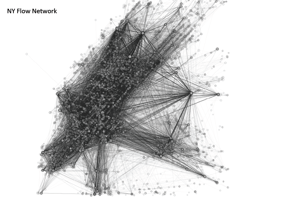
Similar to the way the technology of house numbering produced the abstract space of the coordinate grid, the grammatisation of social space and subsequent organization in places databases produces its own form of abstract space: the ‘place graph’. ‘Place graph’ is a concept that I adopt here from some locative media platforms that use it to designate the data model representing how different places and their respective attributes (place metadata) are related. As Lefebvre remarks, an ‘abstract space functions ‘objectally’, as a set of things/signs and their formal relationships’40. To illustrate, Foursquare’s ‘place graph’ is a network diagram composed of nodes: POIs, connected by different signals or edges: flow (how often people move from one place to another), co-visitation (how often a person visit the place and how many people have been to that place before), place category, or recommendations41 (fig. 5). The ‘place graph’ is a dynamic configuration, fed back in real-time with every new spatial annotation, continuously remapping the city according to mobility flows and social desire. As such it offers a mechanism for the prediction of population mobility. The ‘place graph’ enables the monitoring of the aggregate spatial behaviour of users to find regularities, matches, and make predictions: people who go to X tend to go to Y, or people who go to place category X tend to go to place category Y after. Prediction enables at the same time modulation, for example, the delivery of place recommendations or the targeting of commercial incentives (e.g. offers or coupons) to drive people to places.
Why is it important then how data is indexed spatially? And further, why is even important how space itself is categorized in these socio-technical systems? For a spatial ontology is a system of categorization and ordering of space it presupposes a model of the world. From Graham and Wood’s standpoint, ‘what distinguishes human modes of ordering is the presence of worldviews entwined with the implicit strategies, worldviews that can be translated into new materialities through processes of ordering’42. In this light, the ‘place graph’ abstracts a world in which space is conceived as a collection of discrete spatial entities (POIs), mobile and always becoming as they are never completely fixed to a site, connected not through hierarchical spatial relations but through contingent networking of socio-spatial relations changing in response to the flux of populations and spatial annotations. The ‘place graph’, arguably, constitutes today the diagram that best delineates the intersection between the accelerated dynamism of spaces of consumption in the capitalist city and the digital networked media ontology of flows and personalization, and hence a main site of interrogation of what forms of modulation of urban mobility we may be dealing with in location-based services. While locative media do not represent a development in geocoding techniques in GIS as such, nonetheless, its significance to understand the future shape of the geocoded world resides in the new configurations of their underlying ontologies. There is an emergent shift in the modes of categorization of space – particularly visible in location-based services supported by local advertising – from space (geographical space) to place (social space). At a topological level this development is represented in the emergence of the ‘place graph’ as a diagram of spatial government in locative media.
Places databases offer a mechanism to link our offline and online worlds. In so doing they are central to contemporary mediation of the city. Arguably, we are witnessing increasing reliance on different types of location-based services to navigate urban space (mobile local search, location-enabled social networking, location-based games, augmented reality browsing, etc.). Granted that, and particularly in those cases that rely on places databases built on taxonomies biased towards business services and lifestyle consumption, we should interrogate to what extent these new ‘systems of cardinality’43 constitute biopolitical technologies to sort and order human activity rather than simply provide (geographical) orientation. Programmed not so much to pursue one’s desired destination but to anticipate, or better premediate44, what this desired destination should be.
The critique of the geoindexes underpinning location-enabled communication is critical, therefore, because the models implicit to this mediation, how space as such is coded and computed, directly frame what spaces are geo-annotated (visible space) and subsequently what can we know about them (epistemic space). In other words, what information about places is processed, archived and accessed.
References
Barreneche, Carlos. “Governing the Geocoded World: Environmentality and the Politics of Location Platforms.” Convergence 18 (3) (2012): 331-351.
Brenner, Neil and Theodore, Nik eds. Space of Neoliberalism: Urban Restructuring in North America and Western Europe. (Malden , MA : Blackwell, 2002).
Brighenti, Andrea Mubi. “New Media and Urban Motilities: A Territoriologic Point of View.” Urban Studies, 49(2) (2011): 399-414.
Caplan, Paul. “London 2012: Distributed Imag(in)ings and Exploiting Protocol”. PLATFORM: Journal of Media and Communication 2(2) (2010): 24-39.
Cramer, Florian and Fuller, Matthew. “Interface,” in: Software Studies : A Lexicon, ed. Matthew Fuller (Cambridge, Mass: MIT Press, 2008), 149-152.
Crang, Mike and Graham, Stephen. “Sentient Cities: Ambient Intelligence and the Politics of Urban Space.” Information, Communication & Society, 10(6) (2007): 789-817.
Crutcher, Michael and Zook, Matthew. “Placemarks and waterlines: Racialized cyberscapes in post-Katrina Google Earth.” Geoforum 40(4) (2009): 523-534.
Dodge, Martin and Kitchin, Rob. “Code and the Transduction of Space.” Annals of the Association of American Geographers 95(1) (2005): 162-180.
Galloway, Alexander. “Black Box, Black Bloc,” In: Communization and its Discontents: Contestation, Critique and Contemporary Struggles ed. Noys, Benjamin, (London: Minor Compositions/AK Press, 2011), 237-249.
Gerlitz, Caroline and Helmond, Anne. “Hit, Link, Like and Share. Organizing the social and the fabric of the web in a Like economy.” Conference proceedings Digital Methods Initiative Winter Conference, 24-25 January, 2011.
Google Inc. “Method for Node Ranking in a Linked Database.” US Patent 6285999 (2001).
Goss, Jon. “We Know Who You Are and We Know Where you Live”: The instrumental Rationality of Geodemographic systems.” Economic Geography, 2(71) (1995): 171-198.
Graham, Mark. “Neogeography and the Palimpsests of Place: Web 2.0 and the Construction of a Virtual Earth.” Tijdschrift voor economische en sociale geografie, 101 (2009): 422–436.
Graham, Mark and Zook, Matthew. “Visualizing global cyberscapes: Mapping user-generated placemarks.” Journal of Urban Technology 18(1) (2011): 115–132.
Graham, Stephen. “Software-sorted geographies.” Progress in Human Geography 29(5) (2005): 562–580.
Grusin, Richard. Premediation: Affect and Mediality After 9/11. (London: Palgrave Macmillan, 2010).
Haklay, Muki and Singleton, Alex and Parker, Chris. “Web Mapping 2.0: The Neogeography of the GeoWeb.” Geography Compass 2(6) (2008): 2011-2039.
Harvey, David. “Flexible accumulation through urbanization: reflections on ‘Post-Modernism’ in the American city.” Antipode 19(3) (1987): 260-286.
Hemment, Drew. “Locative arts.” Leonardo 39(4) (2006): 348–355.
Hindman, Matthew, Tsioutsiouliklis, Kostas and Johnson, Judy A. “’Googlearchy’: How a Few Heavily-Linked Sites Dominate Politics on the Web”. (Paper presented at the Annual Meeting of the Midwest Political Science Association, Chicago 31 March, 2003).
Kitchin, Rob and Dodge, Martin. Code/Space: Software and Everyday Life. (Cambridge, MA: MIT Press, 2011).
Kittler, Friedrich. “The city is a medium.” New Literary History, 27(4) (1996): 717-729.
Lash, Scott. Critique of Information. (London: Sage Publications, 2002).
Lefebvre, Henri The Production of Space. (Oxford: Blackwell, 1991).
Levy, Stephen. “How Google’s Algorithm Rules the Web,” Wired Magazine February 22, 2010 Accessed March 25, 2012, http://www.wired.com/magazine/2010/02/ff_google_algorithm/all/1
Microsoft. “Location & Privacy: Where Are We Headed?’, Microsoft Privacy” 2011
Accessed March 25, 2012, http://www.microsoft.com/privacy/dpd/default.aspx.
Rose, Nikolas. Powers of Freedom: Reframing Political Thought. (Cambridge: Cambridge University Press, 1999).
Rose-Redwood, Reuben. “Governmentality, the Grid, and the Beginnings of a Critical Spatial History of the Geo-coded World.” (PhD diss., Pennsylvania State University, 2006).
Stiegler, Bernard. “Our Ailing Educational Institutions”, Culture Machine 5 (5) 2003. Accessed March 25, 2012, http://www.culturemachine.net/index.php/cm/article/viewArticle/258/243.
Stiegler, Bernard. “The Alternative of Metadata: Automated Voluntary Servitude or Economy of Contribution.” (paper presented at The Force of Metadata Conference, Goldsmiths, University of London, London, UK, 29th November, 2008).
Stiegler, Bernard. “Die Aufklärung in the Age of Philosophical Engineering. (paper presented at www2012 Conference, Université de Lyon, Lyon, France, 20th April, 2012).
Terranova, Tiziana. Network Culture: Politics for the Information Age. (London: Pluto Press, 2004).
Wood, David and Graham, Stephen. “Permeable Boundaries in the Software-sorted Society: Surveillance and the Differentiation of Mobility.” (paper presented at Alternative Mobility Futures, Lancaster University, Lancaster, UK, 9-11 January, 2004).
Yahoo Inc., “Interestingness ranking of media objects.” US Patent Application 20060242139 (2006a).
Yahoo Inc., “Media object metadata association and ranking.” US Patent Application 2006/0242178 A1 (2006b).
Zook, Matthew and Graham, Mark. “Mapping DigiPlace: geocoded Internet data and the representation of place.” Environment and Planning B: Planning and Design 34(3) (2007): 466–482.
Zook, Matthew and Graham, Mark and Shelton, Taylor. “Analyzing global cyberscapes: mapping geo-coded Internet information” Proceedings of the 2011 iConference ACM NY, US 2011.
Notes
- Haklay, Muki and Singleton, Alex and Parker, Chris. “Web Mapping 2.0: The Neogeography of the GeoWeb.” Geography Compass 2(6) (2008): 2011-2039. ↩
- Research commissioned by Microsoft in 2011, and carried out in the US, UK, Japan, Canada and Germany, found that, despite the perceived usefulness of location-based services is relatively high, users are still very concerned about potential issues such as unauthorized location sharing, personal information theft, loss of privacy and security threats (see: Microsoft, 2011). ↩
- Graham, Mark and Zook, Matthew. “Visualizing global cyberscapes: Mapping user-generated placemarks.” Journal of Urban Technology 18(1) (2011): 115–132. ↩
- Crang, Mike and Graham, Stephen. “Sentient Cities: Ambient Intelligence and the Politics of Urban Space.” Information, Communication & Society, 10(6) (2007): 789-817. I am also borrowing here from Brighenti (2011), who develops visibility as a conceptual tool to explore the relationship between media and urban space. See: Brighenti, Andrea Mubi. “New Media and Urban Motilities: A Territoriologic Point of View.” Urban Studies, 49(2) (2011). ↩
- Caplan, Paul. “London 2012: Distributed Imag(in)ings and Exploiting Protocol”. PLATFORM: Journal of Media and Communication 2(2) (2010): 24-39. ↩
- Geotagging is used in the article instead of the more overarching term geocoding. Even though geotagging is in fact a form of geocoding, the former corresponds to a non-expert and mainly socially oriented practice as it is used to share the location of a media object or broadcast user location, whereas the latter has been historically ascribed to geographers, cartographers or computer experts. Secondly, the term geotagging as such was allegedly coined by a member of Flickr’s community and gained widespread use within it. It is therefore pertinent to use the language characteristic of the case study under analysis rather than the standard technical terminology. ↩
- Yahoo Inc., “Interestingness ranking of media objects.” US Patent Application 20060242139 (2006a). ↩
- Terranova, Tiziana. Network Culture: Politics for the Information Age (London: Pluto Press, 2004), 16. ↩
- Cramer, Florian and Fuller, Matthew. “Interface,” in: Software Studies : A Lexicon, ed. Matthew Fuller (Cambridge, Mass: MIT Press, 2008), 151. ↩
- Galloway, Alexander. “Black Box, Black Bloc,” In: Communization and its Discontents: Contestation, Critique and Contemporary Struggles ed. Noys, Benjamin, (London: Minor Compositions/AK Press, 2011), 241. ↩
- Google Inc. “Method for Node Ranking in a Linked Database.” US Patent 6285999 (2001). ↩
- Levy, Stephen, “How Google’s Algorithm Rules the Web,” Wired Magazine February 22, 2010 Accessed March 25, 2012, http://www.wired.com/magazine/2010/02/ff_google_algorithm/all/1 ↩
- Yahoo Inc., 2006a Op. cit. ↩
- Yahoo Inc., “Media object metadata association and ranking.” US Patent Application 2006/0242178 A1 (2006b). ↩
- Yahoo Inc., 2006a Op. cit. ↩
- Yahoo Inc., 2006b. Op. cit. ↩
- See: Zook, Matthew and Graham, Mark, 2007; and Crutcher, Michael and Zook, Matthew, 2009; and Graham, Mark, and Zook, Matthew 2011; and Zook, Matthew, Graham, Mark and Shelton, Taylor, 2011. ↩
- Zook, Matthew and Graham, Mark and Shelton, Taylor. “Analyzing global cyberscapes: mapping geo-coded Internet information” Proceedings of the 2011 iConference ACM NY, US 2011. ↩
- Lash, Scott. Critique of Information. (London: Sage Publications, 2002), 28. ↩
- See: Graham, 2005 and Zook and Graham, 2007. ↩
- See: Dodge and Kitchin, 2005 and Kitchin and Dodge, 2011. ↩
- See: Hindman, Matthew, Tsioutsiouliklis, Kostas and Johnson, Judy A. “’Googlearchy’: How a Few Heavily-Linked Sites Dominate Politics on the Web”. (Paper presented at the Annual Meeting of the Midwest Political Science Association, Chicago 31 March, 2003). ↩
- See: Gerlitz, Caroline and Helmond, Anne. “Hit, Link, Like and Share. Organizing the social and the fabric of the web in a Like economy.” Conference proceedings Digital Methods Initiative Winter Conference, 24-25 January, 2011. ↩
- To Stiegler, grammatisation refers to the ‘technical processes that enable behavioural fluxes or flows to be made discrete (in the mathematical sense) and to be reproduced’. Stiegler, Bernard. “Die Aufklärung in the Age of Philosophical Engineering”. (paper presented at www2012 Conference, Université de Lyon, Lyon, France, 20th April, 2012). ↩
- Yahoo Inc., 2006a Op. cit. ↩
- Miller and Rose, 1990 cited in Rose-Redwood, Reuben. “Governmentality, the Grid, and the Beginnings of a Critical Spatial History of the Geo-coded World.” (PhD diss., Pennsylvania State University, 2006, 475. ↩
- Rose-Redwood 2006. Op. cit. ↩
- Rose-Redwood 2006. Op. cit. p.112. ↩
- Rose-Redwood 2006. Op. cit. p.114. ↩
- Kittler, Friedrich. “The city is a medium.” New Literary History, 27(4) (1996): 724. ↩
- Goss, Jon. “We Know Who You Are and We Know Where you Live”: The instrumental Rationality of Geodemographic systems.” Economic Geography, 2(71) (1995): 133. ↩
- Barreneche, Carlos. “Governing the Geocoded World: Environmentality and the Politics of Location Platforms.” Convergence 18 (3) (2012): 331-351. ↩
- See: W3C POI Working Group: http://www.w3.org/2010/POI/ ↩
- See: Brenner, Neil and Theodore, Nik eds. Space of Neoliberalism: Urban Restructuring in North America and Western Europe. (Malden , MA : Blackwell, 2002). ↩
- Harvey, David. “Flexible accumulation through urbanization: reflections on ‘Post-Modernism’ in the American city.” Antipode 19(3) (1987): 267. ↩
- Hemment, Drew. “Locative arts.” Leonardo 39(4) (2006): 348–355. ↩
- Graham, Mark. “Neogeography and the Palimpsests of Place: Web 2.0 and the Construction of a Virtual Earth.” Tijdschrift voor economische en sociale geografie 101 (2009): 433. ↩
- Barreneche 2012 Op. cit. ↩
- Stiegler, Bernard. “The Alternative of Metadata: Automated Voluntary Servitude or Economy of Contribution.” (paper presented at The Force of Metadata Conference, Goldsmiths, University of London, London, UK, 29th November, 2008). ↩
- Henri Lefebvre. The Production of Space. (Oxford: Blackwell, 1991), 49. ↩
- “Machine Learning with Large Networks of People and Places,” Foursquare, accessed July 14, 2012, http://engineering.foursquare.com/2012/03/23/machine-learning-with-large-networks-of-people-and-places/. ↩
- Wood, David and Graham, Stephen. “Permeable Boundaries in the Software-sorted Society: Surveillance and the Differentiation of Mobility.” (paper presented at Alternative Mobility Futures, Lancaster University, Lancaster, UK, 9-11 January, 2004). ↩
- Stiegler, Bernard. “Our Ailing Educational Institutions”, Culture Machine 5 (5) 2003. Accessed March 25, 2012, http://www.culturemachine.net/index.php/cm/article/viewArticle/258/243. ↩
- Grusin, Richard. Premediation: Affect and Mediality After 9/11. (London: Palgrave Macmillan, 2010). ↩